Course Objectives
What will I learn in this Esri ArcGIS course?
You'll learn how to model, manage, and report on data using Esri ArcGIS, including governance practices that keep data consistent and reliable across the organization.
What hands-on skills will I gain from Esri ArcGIS training?
You'll get hands-on experience with industry-relevant Esri ArcGIS tools and workflows through guided exercises, so you learn by doing rather than just reading theory.
How does this course prepare me for real-world Esri ArcGIS work?
The course is designed around how Esri ArcGIS is actually applied to solve real-world problems in professional settings, not just textbook scenarios.
Will I work on real projects during the Esri ArcGIS course?
Yes, the course includes real-time projects and case studies that reinforce Esri ArcGIS concepts through practice, giving you portfolio-ready work by the end.
How does this course help with certification and job interviews?
The course is structured to help you prepare for relevant Esri ArcGIS certifications and interviews, covering the concepts and terminology employers and exam boards expect.
Popular Techniques Covered in This Course
Building data models and reports in Esri ArcGIS
Configuring dashboards and visualizations
Data quality, governance, and stewardship workflows
Setting up data pipelines and refresh schedules
Managing master data and reference data
User roles and access to sensitive data
Integration with source systems and data warehouses
Performance tuning for reports and queries
Troubleshooting data quality and pipeline issues
Certification-aligned exam preparation
Get Hands-on Knowledge about Real-Time Projects
Project 1
Esri ArcGIS Fundamentals Project
A guided, hands-on project where you apply the core concepts and basic tools of Esri ArcGIS to a simple task — designed to build confidence with the fundamentals before moving on to advanced work.
Project 2
Real-World Esri ArcGIS Case Study
Work through a real-world scenario that mirrors how Esri ArcGIS is used on the job, practicing the workflows, decisions, and troubleshooting professionals rely on day to day.
Project 3
Esri ArcGIS Configuration & Setup Exercise
Configure and set up a working Esri ArcGIS environment from scratch, applying what you've learned in a structured, hands-on format with guidance from your trainer.
Project 4
Esri ArcGIS Integration & Automation Challenge
Tackle a practical, open-ended problem involving Esri ArcGIS integration or automation, working through troubleshooting, optimization, and best practices the way you would in a real professional environment.
Project 5
Esri ArcGIS Capstone Project
Bring together everything you've learned into one comprehensive, portfolio-ready project that demonstrates your end-to-end Esri ArcGIS skills to potential employers.
Key Features
This Esri ArcGIS program offers comprehensive hands-on training to prepare you for industry demands.
40 Hours Course Duration
100% Job Oriented Training
Industry Expert Faculties
Free Demo Class Available
Completed 500+ Batches
Certification Guidance
Curriculum
Module 1: Introduction to Esri ArcGIS
- Overview and evolution of Esri ArcGIS
- Industry landscape, use cases, and business value
- Career paths and job roles related to Esri ArcGIS
Module 2: Core Concepts and Terminology
- Key data modeling and reporting terminology in Esri ArcGIS
- How Esri ArcGIS fits into an organization's data and analytics strategy
- Core objects and data model used in Esri ArcGIS
Module 3: Environment Setup and Configuration
- Setting up a working Esri ArcGIS environment
- Initial configuration and system requirements
- Navigating the core interface and tools
Module 4: Architecture and Key Components
- Understanding the underlying architecture of Esri ArcGIS
- Key modules, components, and how they interact
- Data flow and system design considerations
Module 5: Hands-On Tools and Techniques
- Practical, hands-on use of core Esri ArcGIS tools
- Step-by-step configuration and customization
- Common workflows used in real projects
Module 6: Data Management and Administration
- Managing master, reference, and reporting data
- User roles and access to sensitive data sets
- Data quality and governance practices
Module 7: Integration with Related Systems
- Connecting Esri ArcGIS with other enterprise systems
- APIs, interfaces, and data exchange methods
- Common integration patterns and challenges
Module 8: Automation and Workflow Optimization
- Automating repetitive tasks within Esri ArcGIS
- Streamlining workflows for efficiency
- Tools and techniques for process optimization
Module 9: Security, Compliance and Best Practices
- Data governance and compliance considerations
- Access control across data and reporting teams
- Audit trails for data changes
Module 10: Troubleshooting and Performance Tuning
- Identifying and resolving common Esri ArcGIS issues
- Performance tuning and optimization techniques
- Monitoring and diagnostic approaches
Module 11: Real-World Case Studies and Projects
- Applying Esri ArcGIS to practical, real-world scenarios
- Working through guided, project-based exercises
- Learning from common industry implementation patterns
Module 12: Certification Preparation and Capstone Project
- Consolidating skills through a capstone project
- Exam-focused review of key Esri ArcGIS concepts
- Interview preparation and next steps for your career
Receive Training From Our Skilled and Effective Trainers
Learn from Experienced Esri ArcGIS Professionals Gain expertise from experienced Esri ArcGIS professionals who have delivered geospatial analysis and mapping implementations across government, utilities, and urban planning organizations.
Industry Exposure with Enterprise ArcGIS Projects Our ArcGIS trainers bring hands-on experience with ArcGIS Pro, ArcGIS Online, ArcGIS Enterprise, spatial analysis tools, geodatabase design, and StoryMaps, implemented across government and utility mapping projects.
Simple, Practical & Business-Oriented Teaching Approach Core ArcGIS concepts—map and layer creation, spatial analysis workflows, geodatabase management, and web map publishing—are taught through live demonstrations and real geospatial project scenarios.
Hands-On Real-Time ArcGIS Projects Build job-ready expertise through structured labs building spatial analyses, geodatabases, web maps, and StoryMaps using realistic government and utility mapping use cases.
Updated with the Latest ArcGIS Technologies Our ArcGIS curriculum is updated with ArcGIS AI-assisted analysis and evolving cloud GIS capabilities used across modern spatial data projects.
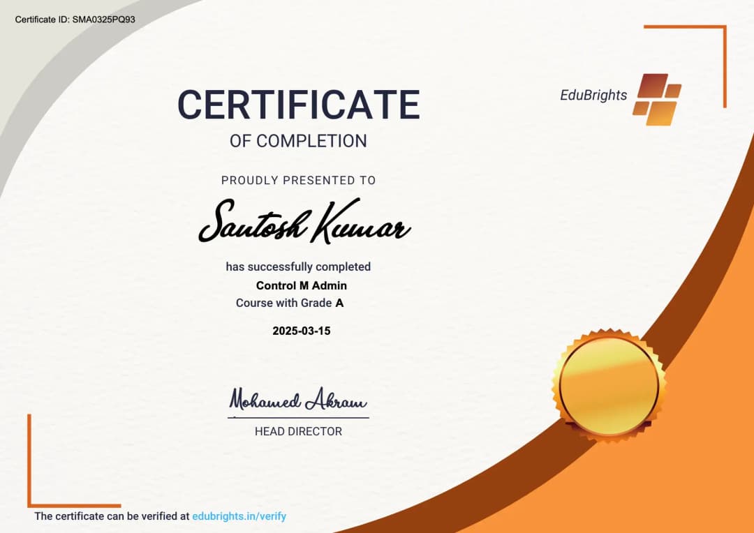
Certified Esri ArcGIS Professional
Our certification validates your expertise in Esri ArcGIS. Gain practical skills to apply Esri ArcGIS confidently in real-world projects. Ideal for professionals and freshers looking to strengthen their Esri ArcGIS career profile.
Course FAQs
What is Esri ArcGIS used for?
Esri ArcGIS is used by organizations to manage, model, and report on enterprise data, helping teams make decisions based on consistent, trustworthy information across departments. It gives teams a standardized way to work instead of relying on scattered spreadsheets, emails, or manual processes. Most organizations adopt Esri ArcGIS specifically because it reduces errors and speeds up day-to-day operations.
What is the duration of Esri ArcGIS training?
Esri ArcGIS training typically runs from a few weeks up to a couple of months, depending on whether you choose a weekday, weekend, or fast-track batch. The exact duration also depends on how deep the course goes into advanced configuration versus just the fundamentals. Most learners can expect a structured path with clear milestones rather than an open-ended timeline.
Who can enroll in Esri ArcGIS training?
Freshers, graduates, working professionals, and career switchers can all enroll in Esri ArcGIS training. Most programs don't require prior experience, though basic computer familiarity helps you move faster through the early modules. If you're coming from a related field, you'll likely find the transition easier since many core concepts carry over.
Is Esri ArcGIS training available online?
Yes, Esri ArcGIS training is available in online, classroom, and hybrid formats, so you can choose the mode that fits your schedule and learning style best. Online batches typically include live instructor sessions plus recordings, so you don't lose access if you miss a class. Classroom and hybrid options add in-person practice time for learners who prefer hands-on guidance.
What topics are covered in Esri ArcGIS training?
Esri ArcGIS training covers core concepts, key tools, hands-on configuration, and practical, real-world exercises, building from fundamentals up to advanced application. The syllabus is usually structured in modules, so you build one skill on top of the previous one instead of jumping around. By the end, you should be comfortable handling the kind of tasks that come up in an actual job role.
Will I receive a certificate after completing Esri ArcGIS training?
Yes, learners receive a course-completion certificate after finishing Esri ArcGIS training, which can be added to your resume and LinkedIn profile. The certificate signals to employers that you've completed a structured program, not just watched a few videos. Some institutes also help you prepare for official vendor certification exams on top of the completion certificate.
Does Esri ArcGIS training include placement assistance?
Many Esri ArcGIS training providers offer placement support such as resume reviews, mock interviews, and introductions to hiring partners. This support usually kicks in toward the end of the course, once you have enough hands-on skills to speak to in an interview. It's worth asking upfront exactly what placement support includes, since it varies a lot between institutes.
What career opportunities are available after Esri ArcGIS training?
Completing Esri ArcGIS training can open up roles across organizations that rely on Esri ArcGIS for their core operations, spanning IT services, product companies, and enterprise consulting firms. Depending on your background, you could move into an implementation, support, or analyst-type role working directly with the platform. Demand tends to be steady because organizations that have already invested in Esri ArcGIS need people who can maintain and extend it.
How is structured Esri ArcGIS training different from free online resources?
Structured Esri ArcGIS training offers guided instruction, hands-on projects, doubt-clearing sessions, and mentor support — elements that are hard to replicate through scattered, free resources alone. Free tutorials are useful for a quick overview, but they rarely follow a coherent path from beginner to job-ready. A structured course also gives you feedback on your work, which self-study generally can't.
Do I need a technical background to learn Esri ArcGIS?
A technical background can help but usually isn't mandatory for Esri ArcGIS training. Beginner-friendly batches start from the basics, so motivated learners from non-technical backgrounds can also follow along. That said, being comfortable with computers and logical thinking will make the learning curve noticeably smoother.
How do I choose the right institute for Esri ArcGIS training?
When choosing a Esri ArcGIS training institute, look at trainer experience, how current the curriculum is, the amount of hands-on project work, batch sizes, and post-training support. It also helps to ask for a syllabus in advance and compare it against what you actually need for your target role. Smaller batch sizes generally mean more individual attention from the trainer.
Are weekend batches available for Esri ArcGIS training?
Yes, most Esri ArcGIS training providers run dedicated weekend batches alongside weekday and fast-track options for working professionals. Weekend batches usually run a bit longer in total duration since there's less class time per week. This makes it a practical option if you're currently employed and can't commit to weekday evenings.
Will I work on real-time projects during Esri ArcGIS training?
Reputable Esri ArcGIS training programs include real-time projects and case studies alongside theory, so you leave with practical, portfolio-ready experience. These projects are usually modeled on situations you'd actually encounter on the job, not simplified textbook examples. Having project work to talk about also makes a real difference in interviews.
What is the typical batch size for Esri ArcGIS training?
Most Esri ArcGIS training providers keep batch sizes small so trainers can give individual attention and adapt the pace of the course to the group's progress. Smaller groups also make it easier to get your specific questions answered rather than getting lost in a large virtual classroom. If batch size matters to you, it's worth asking directly before enrolling, since it isn't always advertised.
Who typically teaches Esri ArcGIS training?
Esri ArcGIS training is usually delivered by trainers with hands-on industry experience, so lessons reflect current tools and practices rather than purely academic material. Many trainers continue working in the field alongside teaching, which keeps the content grounded in what employers actually expect. It's reasonable to ask about a trainer's background before committing to a batch.
Is prior experience required for Esri ArcGIS training?
Depending on the specific program, some Esri ArcGIS training assumes basic familiarity with related concepts, while others are fully beginner-friendly. It's worth checking the prerequisites for your chosen batch before enrolling so you're not starting from behind. If you're unsure, most institutes are happy to advise on whether a course fits your current skill level.
Can I attend a demo class before enrolling in Esri ArcGIS training?
Many Esri ArcGIS training institutes offer a free demo or trial session, letting you evaluate the trainer's teaching style and course structure before committing. This is a good way to check whether the pace and depth of the class actually match what you're looking for. Use the demo to ask questions about the syllabus, project work, and placement support too.
How much does Esri ArcGIS training cost?
Fees for Esri ArcGIS training vary by institute, course depth, and format, so it's best to compare a few providers directly and check what's included, such as materials, projects, and placement support. Online batches are often priced lower than in-person classroom training, though the content covered can be just as thorough. Always confirm whether the quoted fee covers the full course or just a portion of it.
Is Esri ArcGIS training suitable for corporate or group training?
Yes, several Esri ArcGIS training providers offer customized corporate batches for teams, with schedules and content adjusted to match an organization's specific tools and workflows. Corporate training often includes tailored case studies drawn from the company's actual systems and processes. This makes it easier for teams to apply what they've learned immediately after the training ends.
What support is available after completing this training?
Beyond the course itself, many institutes offer post-training support such as doubt-clearing sessions, access to updated materials, and continued placement assistance. Some also give alumni access to updated course content as the tool or platform evolves, so your knowledge doesn't go stale. It's worth asking what post-course support looks like before you enroll, since it varies significantly between providers.
Get Training Quote for Free
Testimonials
Hear What Our Students Say
"Transform your life through Education, hear it from our Alumni"

8 LPA
Rahul
Student
Data Scientist
"Transform your life through Education, hear it from our Alumni"

6 LPA
Fathima
Student
Software Engineer
"Transform your life through Education, hear it from our Alumni"

8 LPA
Siddharth
NIELSON IQ
Data Analyst